


December 2008
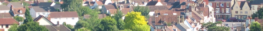
When you think about it, the old part of Thornbury has an abundance of sturdy, venerable-looking walls – rather fewer than there used to be, it is true – but nevertheless, they do seem to pop up all over the place: at the bottom of Kington Lane, by the allotments at the top of the High Street, at the top of the Mundy Fields, and down by St Mary’s church – all over the place in fact. And they all look remarkably similar.
But do they have any significance? Do they have any history? On 9th December Paul Wildgoose, a long-standing member of the Thornbury Local History and Archaeology Society, gave an eagerly anticipated talk on the historic walls and boundaries of the borough and town of Thornbury.
When he first arrived in Thornbury in the 1960s it was still “a place of walls”; the areas of the town now occupied by St Mary’s Centre and the Rock Street car park were once the site of cottages and lanes running between “canyons of walls”. Nearly half of those which stood then have been demolished, but even today some of Thornbury’s historic walls still stand.
All the old walls are of similar construction and built of the same stone. What is the significance of this? Does it mean that they are all of similar date? And are they built of local stone? Four different types of rock can be found in the walls: a dolomitic conglomerate known as “Thornbury Rock”; a red sandstone, of which the porch of St Mary’s church is built; a sandstone quartz conglomerate; and a limestone, such as that of which the old schoolroom of Gillingstool Primary School is built. An examination of the geological map of Thornbury reveals that the town centre and the land to the north of it lies on Thornbury Rock; the Thornbury Beds to the east and west of the centre are composed of sandstone and quartz conglomerate; and to the south of the town, and further east beyond the A38 lies limestone.
The geological map therefore reveals the likely provenance of the stones in Thornbury’s walls; but in order to give weight to this hypothesis it was necessary for Mr Wildgoose to refer to more conventional maps, albeit those of yesteryear, in order to determine whether there were any quarry sites in these areas. The Ordnance Survey map of Thornbury produced in 1881 shows that Quarry Farm at Kington was indeed the site of a quarry, which produced stone from one of the Thornbury Beds, and the walls close to this quarry tend to be predominantly of sandstone or quartz conglomerate. At Alveston, there was a quarry into the limestone which was found there, along with a lime kiln for producing lime mortar which is used in the walls instead of cement. Other quarries also show up on the old maps, and it appears that Thornbury’s walls were all built with stone which was quarried less than a mile from where they stood.
But if you look at the walls, you will notice that many of them are of a considerable height. Why were they built like this? Was it for fortification? This seems unlikely, as, though imposing, those which remain were certainly not of a construction which could withstand military assault. In all likelihood, their construction denotes a variety of purposes. First, they afforded basic protection to the town from vagrants and ruffians; secondly, as Thornbury was a market town, they may well have served to regulate the points of entry into the town – you wouldn’t want some bloke driving his pigs across your burgage plot simply because it afforded the shortest route to the market; thirdly, of course, they provide a clear demarcation between neighbouring plots; and fourth, Prof. Mick Aston (he of Time Team fame) suggests that the height of walls may have been seen as a measure of affluence and status, both on a personal and a communal level, and it may be for this reason that many of Thornbury’s ancient walls are so high. Clear demarcation of the boundaries may also have been necessitated by Thornbury’s status as a borough, granted by a charter of 1252, which gave certain rights to those holding land within the borough. The privileges also brought with them responsibilities – bylaws required the burgesses to maintain their walls to certain specifications, and the records of the Borough Court contain references to those fined for failure to repair the “meets and bounds”.
So just how old are these walls? Do they date back to the Borough Charter? These are difficult questions to answer. A comparison with buildings which can be dated, for example, parts of St Mary’s church or the castle, can help in making educated guesses as to the answers, as can documentary or cartographical evidence, such as court rolls and estate maps. It seems that the lower portions of the sandstone walls may be pre-sixteenth century, but it must be borne in mind that the walls will have been repaired and rebuilt as required over the centuries. Limestone was not quarried in the area until about 1800, so walls build of limestone can be assumed to have been erected after this date.
It seems, then, that we have an oft-forgotten treasure in Thornbury’s ancient walls; an integral part of the history of the town. Let us hope that those which remain can be preserved for future generations. As the old saying goes, “If these walls could talk....”
The Thornbury Local History and Archaeology Society always welcomes new and occasional members. Details of our programme can be found on this website, the library or the Town Hall. Our meetings are on the second Tuesday of the month, held at St Mary's Church Hall beginning at 7.30pm. Visitors are always welcome at the society for the small charge of £3.50